Goradongar Fm
Type Locality and Naming
Local: Goradongar range, section along south-eastern flank of Modar Hill Dome, Pacham Island (Biswas, 1977)
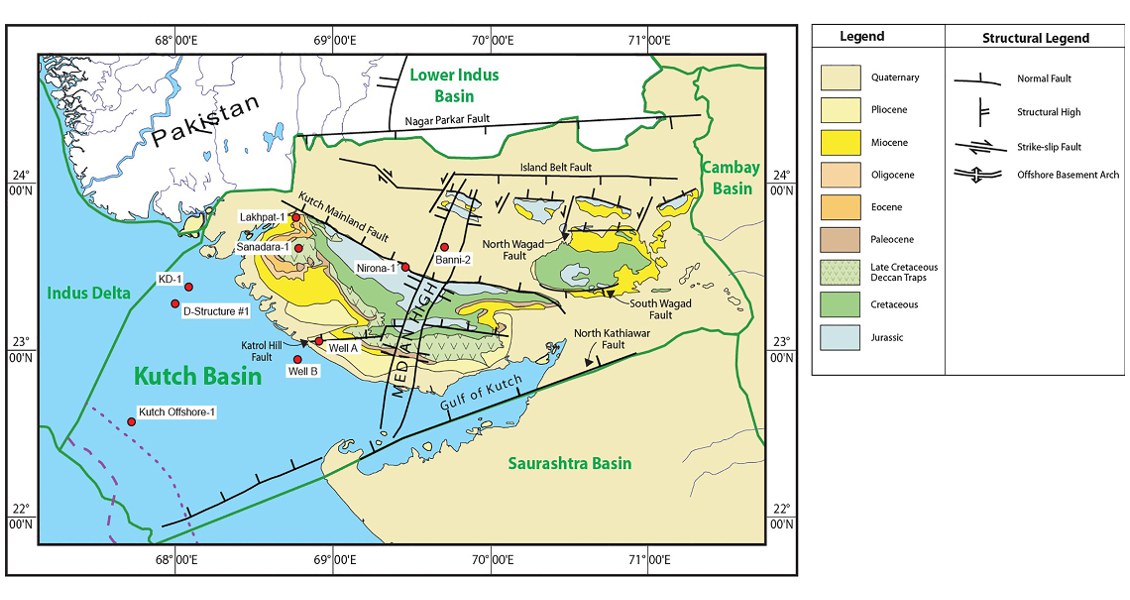
[Fig. Geological and structural map of Kutch, also showing the onshore and offshore wells drilled for oil exploration. (Map by Rasoul Sorkhabi in GeoExpro Dec2014, based on various sources including S.K. Biswas, Current Science, 25May2005)]
Lithology and Thickness
Sandstone to limestone. Massive sandstone, grey gypsiferous shale, flag stone, ferruginous shale, limestone with chert nodules; golden oolitic limestone towards the base. It has been divided into three units, upper, middle and lower, with flagstone appearing in the middle unit. In the type area, it is 150 m thick; in offshore well GK-29A-1 it is 300+ m thick
Relationships and Distribution
Lower contact
Unconformable, the next older regional unit is either the Kaladungar Fm or the Lodai Fm
Upper contact
Not exposed, but next younger regional unit is the Jumara Fm
Regional extent
GeoJSON
Fossils
Ammonites, Brachiopods, Corals, Corbula sp., Gerville sp., Trigonia sp.
Age
Depositional setting
Infra littoral to sub littoral (transgressive) environment
Additional Information
